

STRANGE WATERS
Hard-earned advice for successfully tackling a backcountry lake you’ve never fished before
Advertisement
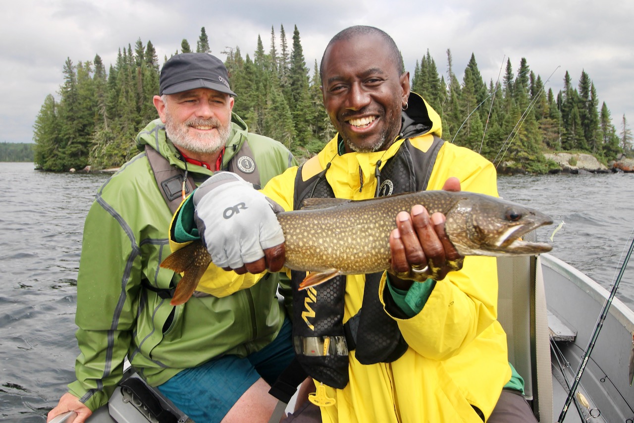 Mark Ventresca watches as Wes Nelson boats another trout on northern Ontario’s Dayo Lake
It was after dinner and still fully daylight when I steered us toward the most prominent island on Dayohessarah Lake. We were three days into our week-long outpost trip in northern Ontario. Dayo, as it’s commonly called, is a classic Shield lake known for its strain of wild lake trout, with genetics going back to the last ice age, unspoiled by even a whisper of stocking.
A south wind had been sweeping down the long narrow basin of the lake, strengthening throughout the day, and whitecaps had appeared, along with a small swell. Waves slapped the aluminum hull as I worked the tiller, nudging us to within a few boat lengths of the island’s rocky shoreline, where the bottom shelved up from 80 feet to about 25 over the length of a couple of soccer fields.
Advertisement
“You guys good?” I called.
Wes Nelson was adjusting the swimbait on his ¾-ounce jig. Mark Ventresca was untangling the landing net, and setting it close to hand. They looked at me and smiled, which I took as a yes. I clunked the outboard into neutral. Two jigs went down. I was still shaking my own off the keeper when Mark executed a mighty hookset.
“I’m on,” he said, as his rod bent sharply.
Advertisement
He’d only cranked in a couple of times, when Wes said, “Me too.”
A better friend than me would have reeled up to keep out of their way. I was considering it, but then my rod loaded up, and I had a laker on as well. It was a triple header, and just minutes into our first drift of the evening. That morning, we had already landed a few trout at the same island, which first caught our attention two days earlier when we picked up a couple of fish trolling past it. But this post-dinner fishing session was something else.
Advertisement
We landed two of the three fish—I lost mine, too distracted from watching the other guys, and I had to nudge the motor anyway to keep us off the rocks (at least that’s how I’m telling the story). Once the fish were released, we motored back upwind, then drifted down the same stretch, repeating the process six or seven times.
We didn’t hook up on every pass, but we had action on most of them. During one pass, I felt a sharp tap just off the bottom, lifted into nothing and kept retrieving. I looked over the side, and as my jig came up from the 80-foot depths, I saw a laker following it. I kept reeling and the fish broke the surface snapping at my jig. Wes, in the middle seat, saw the whole thing, and his eyes went wide.
“I’ve heard they sometimes do that,” he said, watching my rod bend and vibrate. “I just didn’t quite believe it.”
Eventually the sky turned orange and the shadows began to lengthen, so we pointed the bow back toward our cabin. It had been the best fishing of the trip so far, and we felt like we’d earned it.
Over six days on Dayo Lake, the three of us caught dozens of lake trout—we didn’t crack all of the lake’s secrets, but we did figure out how to find the fish, stay on them and make the most of our limited time. As it turned out, lessons learned from years of increasingly successful backcountry trips for walleye, pike and bass transferred surprisingly well. Here are the key principles for quickly getting into the action on unfamiliar water, especially when you’re in the back of beyond.
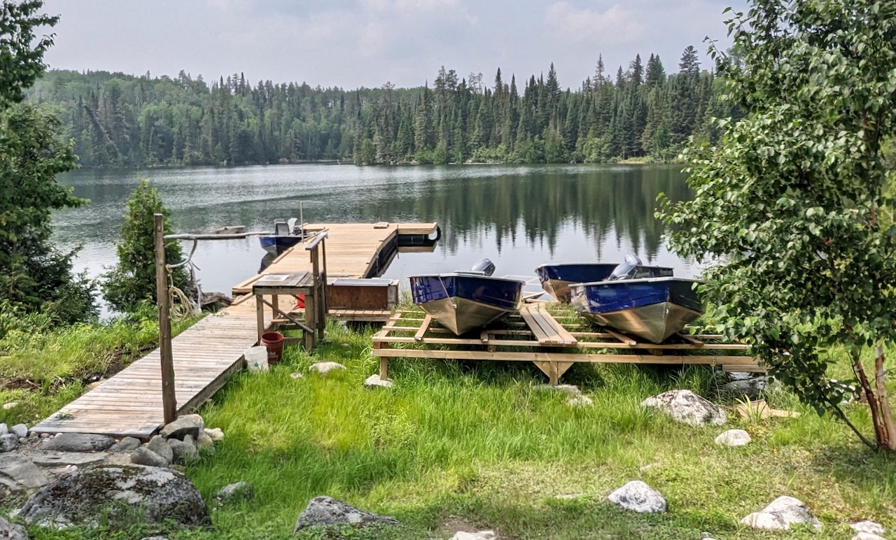 Using contour maps and satellite views gave the crew a leg up on remote Dayohessarah Lake (above)
#1 STUDY MAPS, NOT RUMOURS
Naturally, everyone wants the inside scoop about a lake or river from anglers who’ve been there before. That might be useful on popular, heavily fished waters, but not in the backcountry. Okay, so Darren caught a 12-pounder by the big rock in 2017. Was he jigging or trolling? At what depth or speed? What was the wind like? That tidbit is actually useless—or worse than useless since it might lead you to waste days fishing by that dumb rock.
Instead, when you’re researching a remote lake, focus on physical features you can find on a contour map: humps, points, drop-offs, channels, inflows and outflows. That will help you identify high-probability areas even before you start packing your tackle. Using contour maps of Dayo, for example, we identified likely trolling lanes, plus some humps, canyons and spires. This can inform your tackle choices, too. Noting that some likely spots dropped to 100 feet, we took jigs as heavy as an ounce. Those proved essential, especially when drift-jigging in a brisk wind.
While a contour map is the gold standard, Google Earth can offer extra context from the landscape. You can see if the waterbody is rocky or surrounded by muskeg, and sometimes even spot weedbeds and current patterns. In an unplanned but extremely helpful twist, Mark’s background as a botanist and geographer meant that, although he’d barely held a fishing rod before, he was aces at reading contour maps. Useful guy.